GIS Courses
GIS courses can help you learn spatial analysis, cartography, remote sensing, and data visualization techniques. You can build skills in geographic data management, interpreting satellite imagery, and creating interactive maps. Many courses introduce tools like ArcGIS and QGIS, that support analyzing geographic information and presenting findings effectively. You’ll also explore applications in urban planning, environmental monitoring, and disaster management, allowing you to apply your knowledge in various practical contexts.
Popular GIS Courses and Certifications
 Status: Free Trial
L&T EduTech
Skills you'll gain: Geospatial Information and Technology, Spatial Analysis, GIS Software, Spatial Data Analysis, Geographic Information Systems, Geospatial Mapping, Construction Engineering, Database Management, Construction, Construction Management, Architecture and Construction, Global Positioning Systems, Visualization (Computer Graphics), Civil and Architectural Engineering, Decision Support Systems, Building Information Modeling, Survey Creation, AutoCAD Civil 3D, Data Manipulation, Network Analysis
 Status: Free Trial
University of Toronto
Skills you'll gain: Geographic Information Systems, Geospatial Mapping, Data Mapping, Spatial Data Analysis, Data Visualization, Metadata Management, Quantitative Research, Spatial Analysis, Typography, Data Manipulation, Data Modeling, Design Elements And Principles, Data Import/Export
 Status: Free Trial
Case Western Reserve University
Skills you'll gain: Exploratory Data Analysis, Spatial Data Analysis, Spatial Analysis, Geospatial Mapping, Geospatial Information and Technology, Descriptive Statistics, Statistical Modeling, R Programming, Geographic Information Systems, Statistical Analysis, Probability & Statistics, Data-Driven Decision-Making, Oil and Gas, Data Analysis, Simulations, Statistical Methods, Rmarkdown, Data Cleansing, Box Plots, Plot (Graphics)

Skills you'll gain: Spatial Data Analysis, Geographic Information Systems, Geospatial Information and Technology, Geospatial Mapping, Data Analysis, Big Data, Data Visualization, Analytics, Google Cloud Platform, Network Analysis, Cloud Management, Data Access, Query Languages
 Status: Free Trial
University of Toronto
Skills you'll gain: Spatial Analysis, Geographic Information Systems, Geospatial Mapping, ArcGIS, Data Visualization, Data Compilation, Data Mapping, Data Storytelling, Metadata Management, Data Integration, Data Management
 Status: Free Trial
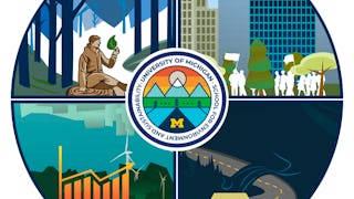
University of Michigan
Skills you'll gain: Sustainable Development, Social Justice, Sustainable Systems, Geographic Information Systems, Organizational Change, Sustainable Business, Environmental Policy, Environmental Regulations, Geospatial Mapping, Culture Transformation, Organizational Effectiveness, Sustainability Reporting, Spatial Data Analysis, Environmental Social And Corporate Governance (ESG), Environmental Issue, Strategic Leadership, Leadership, Collaboration, Financial Analysis, Critical Thinking
 Status: Free Trial
University of Michigan
Skills you'll gain: Data Visualization, Exploratory Data Analysis, Plot (Graphics), Statistical Analysis, Data Presentation, Ggplot2, Program Evaluation, Policy Analysis, Surveys, Data Ethics, R (Software), Data Analysis, Tidyverse (R Package), Statistical Visualization, R Programming, Statistical Methods, Public Policies, Data Visualization Software, Case Studies, Political Sciences
 Status: New
Skills you'll gain: Spatial Data Analysis, GIS Software, Geospatial Information and Technology, Spatial Analysis, Geographic Information Systems, Geospatial Mapping, User Interface (UI), Application Development, Python Programming, Application Design, Data Science, Application Deployment, User Interface (UI) Design
 Status: NewStatus: Free Trial
Logical Operations
Skills you'll gain: Data Storytelling, Data Presentation, Dashboard, Microsoft Excel, Data Visualization Software, Pivot Tables And Charts, Geospatial Information and Technology, Spreadsheet Software, Geospatial Mapping, Data Analysis, Productivity Software, Microsoft Office, Microsoft 365
 Status: Free Trial
University of Michigan
Skills you'll gain: Sampling (Statistics), Sample Size Determination, Survey Creation, Data Collection, Statistical Analysis, Data Analysis Software, Interviewing Skills, Surveys, Research Design, STATA (Software), Data Integration, Data Validation, Data Ethics, Data Analysis, Stata, Data Quality, Statistical Modeling, Qualitative Research, Data Cleansing, R Programming

Northeastern University
Skills you'll gain: Database Design, Software Quality Assurance, Enterprise Architecture, Open Web Application Security Project (OWASP), Data Governance, User Research, Stakeholder Engagement, Algorithms, Agile Software Development, Software Development Life Cycle, Unified Modeling Language, Software Architecture, Cybersecurity, Responsive Web Design, Java, Cascading Style Sheets (CSS), Graph Theory, Agile Methodology, Object Oriented Programming (OOP), Data Ethics
 Status: Free Trial
Microsoft
Skills you'll gain: Generative AI, Microsoft Copilot, Generative Adversarial Networks (GANs), Natural Language Processing, Data Quality, Anomaly Detection, Data Storytelling, Technical Communication, Responsible AI, Data Visualization, Data Ethics, Data-Driven Decision-Making, Interactive Data Visualization, Data Pipelines, Data Cleansing, Data Visualization Software, Data Preprocessing, Data Science, Autoencoders, Critical Thinking
In summary, here are 10 of our most popular gis courses
- Geospatial Techniques for Engineers: L&T EduTech
- GIS Data Acquisition and Map Design: University of Toronto
- Practical Geospatial Geostatistical Modeling: Case Western Reserve University
- Getting Started with BigQuery GIS for Data Analysts: Google Cloud
- GIS, Mapping, and Spatial Analysis Capstone: University of Toronto
- Green Skills for a Sustainable and Just Future: University of Michigan
- Data Analytics in the Public Sector with R: University of Michigan
- Python Geospatial Development Essentials: Packt
- Excel: Dashboards and Geospatial Visualizations: Logical Operations
- Survey Data Collection and Analytics: University of Michigan


